WEB SERVICE LAYERS
QGIS is designed to promote third-party plugins, and an easy way to acquire dynamic background maps and imagery through a web service is through the OpenLayers plugin:
1. Select Plugins >> Manage and Install Plugins

2. Make sure that the box to the left of the Open Layers plugin is checked, then click Close
![]()
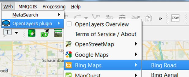
3. Select Web >> Open Layers plugin >> and then Bing Maps >> Bing Road.

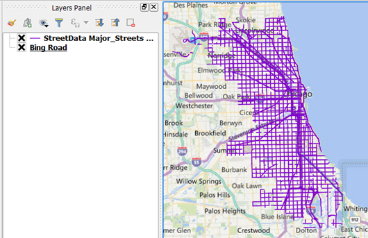
The street view should load on top of your other layers – drag it down so it doesn't obscure them. If you have a decent internet connection it should load fairly quickly:

Feel free to try other map services. Warning: I've found Google's services to load poorly in QGIS (but that's just my experience).
In the next section, we'll add crime locations as points from xy coordinates in a *.csv table.